調査報告
Brief findings of the field reconnaissance survey for GLOF hazard assessment along the middle streams of Mangde Chu in Trongsa Dzongkak, Bhutan
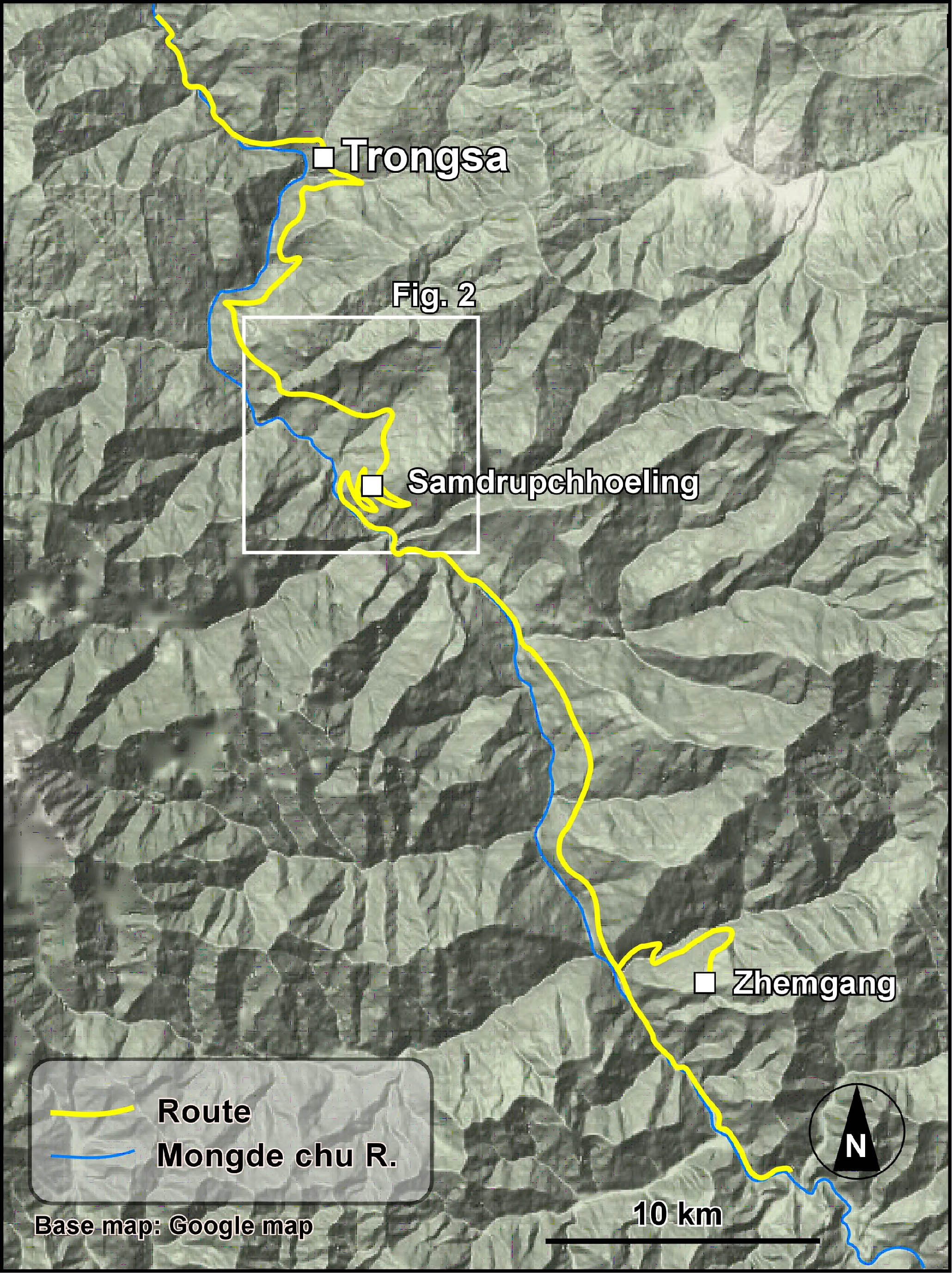
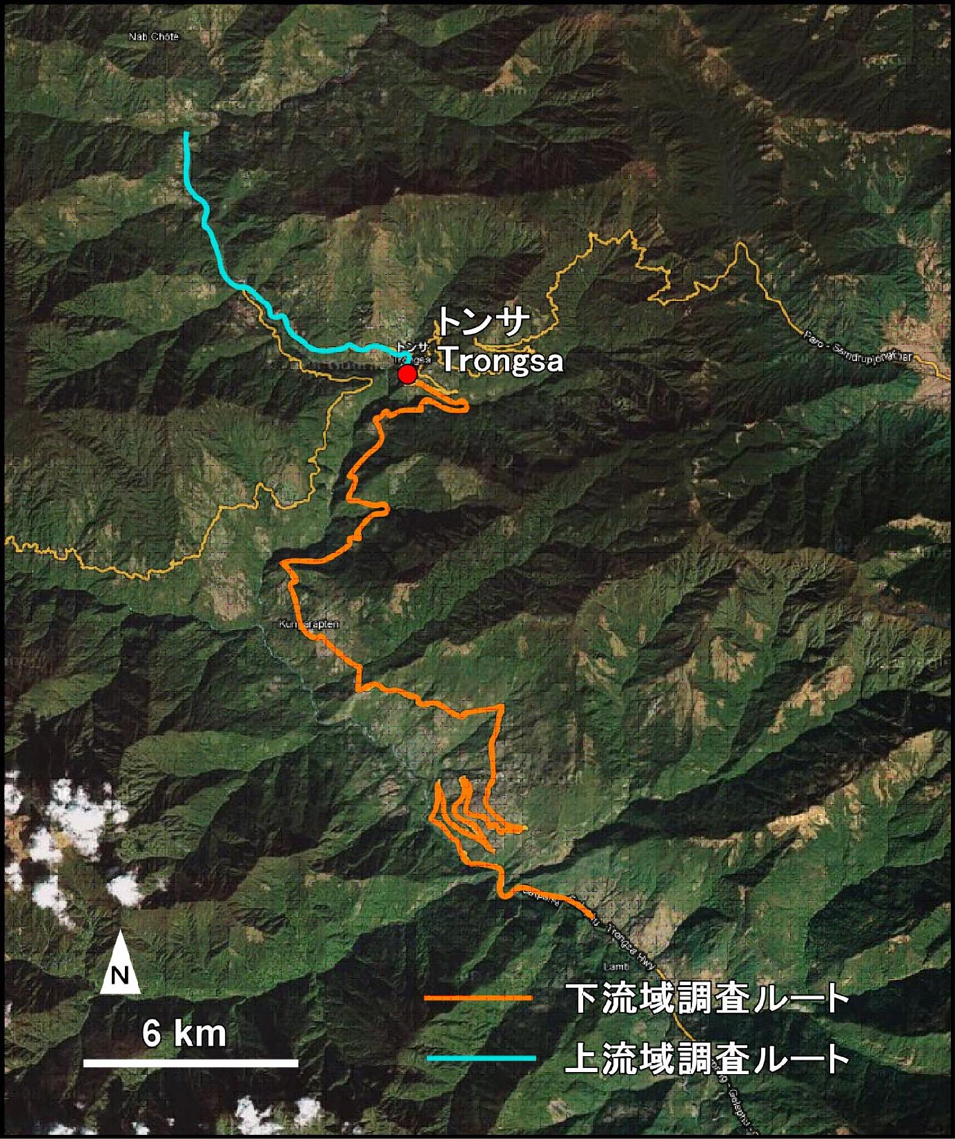
A hazard assessment survey under the Study on GLOFs in the Bhutan Himalayas Project (Department of Geology and Mines, Ministry of , Royal government of Bhutan, JICA/JST and Nagoya University) has been carried out along the middle streams of Mangde Chu in Trongsa Dzongkak on 3-10 Sept 2009. We mainly focused on the topographical and geological settings and distribution of risky infrastructures, settlements and farmlands from Pyela ( 5 kilometers upstream from the Trongsa Bridge to Linchuring. Brief results of the field study are described as follows.
1. Topographical and geological settings and expected hazard around Trongsa
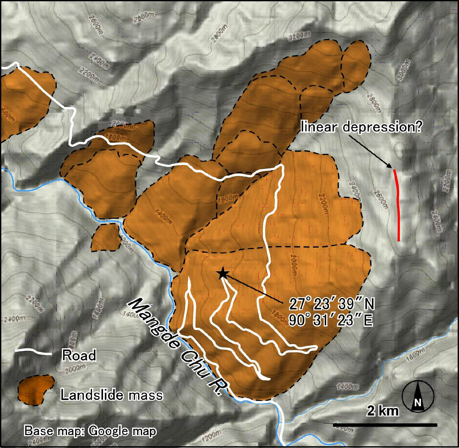
The Mangde Chu has formed narrow and deep V-shaped valleys. Most of the studied segment of the river bank consists of hard gneiss, schist and phyllite. However the left bank slopes from Taktse to Samchholing are mostly wide gentle slopes of deep-seated landslide origin. Clear cracks on the road retaining walls indicate recent movement of landslide. It is expected that the bank consisting of landslide deposits might be easily eroded during the GLOF flood time. Retrogressive landslides also be expected.
A recent large-scale debris flow deposits was found along the Wachi Chu from Black Mts. It blocked the Mangde Chu stream and a small natural dam was formed by the debris flow ,and it breached out due to recent heavy rain. Downstream of the confluence huge amount of sediment has been deposited though the down-cutting erosion continues.
There are some levels of fluvial terraces in the upstream of Trongsa bridge. In case that Such deposits expose at the river banks, shallow landslide might occur during the GLOF. Further field survey is necessary. Present debris slides that are mostly shallow and appear as naked steep slopes, are found on the slopes of old landslides. Many of them can be detected from interpretation of aerial and satellite images.
2. Risky infrastructures, settlements and farmlands
Most houses are not distributed near the river. However, future new settlement near the banks will be risky. Farmlands also are mostly distributed on the slopes far from the river. However those located on the deep-seated landslide slopes might become hazardous when the retrogressive landslides occur.
Though a GLOF simulation is first necessary, bridges in the study segments might be broken. Houses and school, offices near the Trongsa bridge seems quite risky.
We heard that The Mangde Chu Hydro Power Project will be located near the confluence of the Wachi Chu and Mangde Chu. It is recommended that locations of structures such as the sub transmission station, outlet of the water from generator are taken into consideration of GLOF with heave sediment load. Erosion control measures also be recommended.
The GLOF hazard assessment of Mangde Chu is a model case study of GLOF in Bhutan Himalayas. Through it the technological transfer as well as finding the prospective of GLOF hazard management along the river should be gained.
調査日程
9/2 バンコク−パロ−ティンプー/JICA事務所・地質鉱山局にて打合せ
9/3 ティンプー/地質鉱山局にて打合せ
9/4 ティンプー−トンサ
9/5-9 トンサ下流域調査
9/10 トンサ−ティンプー/JICA事務所・地質鉱山局にて打合せ
9/11 ティンプー/JICA事務所・地質鉱山局にて調査報告
9/12-17 ティンプーにて土質試験 (梅村)